
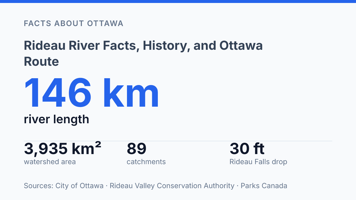
The Rideau River is not just an Ottawa landmark: it is a 146-kilometre waterway draining 3,935 square kilometres, with about 23% of that watershed inside the city’s boundaries. That scale explains why a river often noticed at parks, bridges, and Rideau Falls also belongs to a much larger system of lakes, plains, highlands, and urban drainage. Its route begins at Upper Rideau Lake and ends where twin falls drop 9.1 metres into the Ottawa River, the feature that prompted Samuel de Champlain’s French name in 1613.
The river also carries an older Anishinàbemowin name, Pasapkedjinawong, meaning “the river that passes between the rocks.” Understanding those layers clarifies why the waterway matters to Ottawa geography: it is at once a natural boundary, a drainage network, a naming record, and one of the city’s defining waterways.
Course and key places along the river
A north-flowing route of 146 kilometres (91 mi) carries the Rideau River from lake country into the centre of Canada’s capital. Its source is Upper Rideau Lake in Eastern Ontario, from which the waterway runs generally north toward Ottawa rather than south toward the St. Lawrence system. That orientation is a basic but useful geographic clue: the river’s course links inland lakes, rural communities, and the urban edge of Ottawa along one continuous drainage line.
According to the City of Ottawa, the river is 146 km long, drains 3,935 km², has about 23% of its watershed inside Ottawa’s city boundaries, originates at Upper Rideau Lake, and enters the Ottawa River at Rideau Falls. The figures show that the river is not only a visible Ottawa feature but also part of a much larger drainage area extending beyond the city.
The mouth of the river is at the Ottawa River at Rideau Falls in Ottawa, Ontario. This endpoint gives the route a clear geographic finish: water from the upper lakes and intervening valley reaches the capital before joining the larger Ottawa River system. On a map, the line from Upper Rideau Lake to Rideau Falls is relatively direct, but its importance comes from the places it connects, moving from rural eastern Ontario into dense urban space.
Why the river was named Rideau
The French label was not originally a description of the whole waterway, but a comparison prompted by the falls’ curtain-like drop. In 1613, Samuel de Champlain recorded the explanation that “Rideau” was used because the falling water resembled a curtain, making his writing the earliest named source in this outline for the origin of the name.
The French word “Rideau” means “curtain,” and the reference is visual rather than geographic. Parks Canada describes Rideau Falls as twin falls with a drop of 30 ft / 9.1 m, a form that helps explain why a French observer would connect the site with the image of hanging fabric. The name therefore preserves an early European impression of one landmark, not a technical description of the river’s length, drainage, or route.
That distinction matters because place names often compress a larger feature into a single memorable point of contact. Here, the falls supplied the image that became attached to the river, while the word itself carried the metaphor. The result is a French colonial-era name rooted in appearance: a curtain of water at the falls became the identifier for the wider waterway known by that label in English and French usage.
Anishinàbemowin name and meaning
The Anishinàbemowin name Pasapkedjinawong preserves a geographic observation that a colonial place-name does not: the river is identified by the way its channel passes through rock. According to Carleton University, Pasapkedjinawong means “the river that passes between the rocks,” a meaning tied directly to the physical form of the watercourse rather than to later European naming conventions.
That distinction matters because the two names emphasize different features of the same place. The name discussed earlier draws attention to the appearance of the falls, while Pasapkedjinawong describes the shape and passage of the river itself. One is a visual impression of falling water; the other is a spatial description of movement through a rocky channel.
Read in this way, the Anishinàbemowin name is not simply an alternate label. It records a relationship between language and landform, where the name functions as description, orientation, and memory. The meaning also helps clarify that the river’s named history did not begin with colonial mapping, even though colonial names became dominant in official usage.
Why the river matters in Ottawa geography
Few mid-sized Canadian rivers gain as much map prominence from their endpoint as this one, which meets the Ottawa River beside one of the capital’s best-known natural landmarks. At its mouth in Ottawa, Ontario, Rideau Falls functions as both a physical confluence and a visible reference point, tying the waterway’s course to the geography of Canada’s capital rather than leaving it as a regional feature known only along its banks.
Within Eastern Ontario, Canada, the river is part of a larger drainage setting that helps organize local geography beyond the city core. The Rideau Valley Conservation Authority describes its jurisdiction as an approximately 4,000-square-kilometre watershed extending from headwater areas in Central Frontenac north to downtown Ottawa and east to Clarence-Rockland. That scale makes the river useful as a geographic anchor: it connects rural, small-town, and urban areas within one recognizable valley system.
Ottawa’s own planning material reinforces that urban role. The City of Ottawa identifies four primary waterways in its downtown urban design context: the Ottawa River, the Rideau waterway, the Rideau Canal, and the LeBreton Flats Aqueduct/Tailrace. Being grouped with these features shows that the river is not merely at the edge of the city’s geography; it is one of the lines that helps define the capital’s central form.
The river’s visibility is therefore disproportionate to its size by Canadian standards. Its importance comes less from national-scale length than from position: it approaches a major urban centre, reaches the Ottawa River at a named landmark, and forms part of the spatial framework by which Ottawa and the surrounding Eastern Ontario watershed are understood.
What the watershed frame changes
Reading the river as a watershed, not a single blue line on a map, changes the practical questions Ottawa has to ask. A 4,000-square-kilometre drainage area divided into eight subwatersheds and 89 catchments means that land use, stormwater, shoreline access, and water testing are connected across places that may seem separate.
The 2025 Carleton sampling results, with early readings below Ontario’s recreational threshold, are useful because they show conditions at measured sites and dates, not because they settle the river’s condition for every reach or season. The next layer of understanding is local and repeatable: maps explain where the water goes, names explain what people noticed, and monitoring shows how the river is responding now.
Frequently Asked Questions
Q: Where does the Rideau River start and end?
A: The river begins at Upper Rideau Lake in Eastern Ontario and flows north until it reaches the Ottawa River at the Rideau Falls in Ottawa. This course explains why it is tied closely to the Ottawa route and surrounding waterways.
Q: How long is the Rideau River?
A: Its length is 146 kilometres (91 mi). That scale makes it a major regional river rather than a short urban waterway, with a long northern flow through eastern Ontario.
Q: Why is it called the Rideau River?
A: The name comes from Samuel de Champlain’s 1613 writing, which linked the river to the curtain-like appearance of the Rideau Falls. In French, Rideau means
Q: What does Pasapkedjinawong mean?
A: Pasapkedjinawong is the Anishinàbemowin name for the river. It means “the river that passes between the rocks,” which describes a visible physical feature of the waterway.
Q: Is the Rideau River in Ottawa?
A: Part of the river reaches Ottawa, but it is not limited to the city. It flows through Eastern Ontario and ends in Ottawa at the Rideau Falls, so the river connects a broader inland route with the capital.