
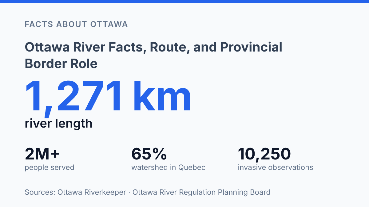
At 1,271 km, the Ottawa River is both the St. Lawrence River’s largest tributary and a drinking-water source for more than 2 million people. Its geography is less evenly divided than its role as a provincial boundary might suggest: 65% of the watershed lies in Quebec, compared with 35% in Ontario. The river also carries more than one identity, from the English name to Kichi Zibi and the French Rivière des Outaouais, a name tied to its historic-site designation in Quebec on August 14, 2017.
Those layers help explain why the river matters as a route, a border, a cultural reference point, and a working waterway. The article examines its course toward the St. Lawrence, the origins of its names, its place in Eastern Canada’s trade history, and the features that distinguish it among Quebec rivers.
Where the Ottawa River runs
The Ottawa River runs for 1,271 km and is the largest tributary to the St. Lawrence River, while also supplying drinking water to more than 2 million people, according to Ottawa Riverkeeper. That scale explains why the river is not only a line on a map, but also a major part of the larger St. Lawrence drainage system in Eastern Canada.
Its course lies within the Canadian provinces of Ontario and Quebec. For most of its length, the river defines the boundary between the two provinces, giving it an unusually clear political role compared with rivers that sit entirely inside one jurisdiction. Cities, shorelines, bridges, water-management decisions, and regional planning are shaped by that shared geography because the same river corridor belongs to two provincial contexts at once.
The border description, however, does not capture the full geography of the basin. The Ottawa River Regulation Planning Board reports that the watershed is 65% in Quebec and 35% in Ontario, which means the drainage area is more Quebec-weighted than the provincial-boundary framing may suggest. This distinction matters because a river can function as a border along its main channel while its watershed extends unevenly across surrounding territory.
As a major tributary, the river’s importance also extends downstream. Its waters feed into the St. Lawrence system west of Montreal, linking the Ontario-Quebec boundary region to one of Canada’s principal river networks. The result is a waterway with two geographic identities: it separates provinces for much of its route, yet it also connects them through a shared basin and a larger continental drainage system.
Why the river has two names
The English name Ottawa preserves a trading identity, while the Algonquin names Kichi-Sìbì and Kitchissippi describe a great river rather than a colonial boundary. The name Ottawa is linked to an Algonquin word meaning “to trade,” reflecting the river’s earlier function as a route of exchange among Indigenous peoples and, later, fur-trade networks. That origin matters because the name records use before jurisdiction: movement, exchange, and connection came before the river’s modern political interpretation.
In French, the river is called Rivière des Outaouais, a form that carries the same historical association through French-language usage. The term Outaouais is tied to the people and trading networks associated with the waterway, so the French name is not simply a translation of an English label. It reflects the way French colonial records and settlement geography absorbed Indigenous-linked names into official place naming.
Algonquin naming adds a different layer. Ottawa Riverkeeper notes that the watershed is known as Kichi Zibi in English-language reporting on Algonquin naming, with spelling variants across dialects including Kichi, Kitchi, Sibi, and Zibi.
Kichi-Sìbì and Kitchissippi are commonly rendered as “great river” or “big river,” terms that emphasize physical scale and cultural presence rather than a provincial line. Taken together, the names show that the river’s identity is layered: Algonquin description, trade-based naming, and French colonial usage all remain visible in the words attached to it.
Its role in Eastern Canada’s trade network
Before railways and all-season roads displaced water transport, this river functioned less like a boundary than a main commercial artery for Eastern Canada. In the period when moving goods most efficiently meant following navigable water, it served as the major trade route of Eastern Canada, linking interior travel corridors with wider commercial waterways. That role made the river strategically significant because control, access, and knowledge of its route affected movement across a much larger region than its banks alone.
Its usefulness came from connection rather than isolation. According to the Ottawa River Regulation Planning Board, the watershed includes more than 15 tributaries, a network that helped draw inland areas toward the main channel and then outward to broader routes used for commerce. Tributaries mattered because they expanded the practical reach of river transport: settlements, portage routes, and mapped corridors could be organized around access to the water system rather than around later road or rail alignments.
The river’s trade value declined as newer transport systems reduced dependence on long-distance river travel, but the historical imprint did not disappear. Quebec’s heritage register records a historic-site designation for the river on August 14, 2017, reflecting its recognized cultural and historical role rather than only its physical scale. This helps explain why the waterway carries significance beyond local geography: it shaped how inland regions were connected, how movement was planned, and how the region was understood on maps long before modern provincial-border framing became the dominant way to describe it.
Why it stands out among Quebec rivers
Quebec’s longest river is not a purely Quebec river. That distinction is central to why it stands apart: its Quebec status depends on scale, but its meaning also comes from the way it links Quebec to Ontario rather than remaining enclosed within one provincial map. In provincial terms, the river is notable because it is officially identified in Quebec’s cultural heritage records as the longest river associated with the province, a superlative that gives it geographic weight even before its historical role is considered.
Its border-setting function adds a second layer of significance. A river that marks jurisdiction is not simply a physical feature; it helps organize settlement, administration, transport memory, and regional identity on both sides of the channel.
For Quebec, this means the river is both an internal geographic landmark and an edge feature, shaping how the province connects with neighbouring territory. Its importance is therefore not measured only by distance, but also by the political geography created along much of its course.
This dual status explains why the river is often framed in both geographic and historical terms. Geographically, it stands out because of its exceptional length within the Quebec context.
Historically, it stands out because that same long corridor became tied to movement, naming, and boundary formation over time. The nuance is important: being Quebec’s longest river does not mean it belongs exclusively to Quebec, and that cross-provincial character is part of what makes it one of the province’s most significant waterways.
Why the border line is only part of the story
A river that marks a boundary can appear politically simple, but this basin resists that interpretation. Its management depends on geography that no border can fully organize: 13 principal reservoirs influence flows, yet more than 60% of the watershed lacks major storage for spring runoff. That limit matters as flood planning, hydropower operations, drinking-water protection, and invasive-species monitoring become more data-driven.
The practical consequence is that the river is best understood as a shared system with unequal provincial geography, layered names, and infrastructure that can reduce risk without controlling the whole basin. Its border role is visible on maps; its real significance appears in the connections upstream and downstream.
Frequently Asked Questions
Q: Where does the Ottawa River flow?
A: The Ottawa River flows through the Canadian provinces of Ontario and Quebec. For most of its length, it forms the boundary between those two provinces before joining the St. Lawrence River.
Q: Why is the Ottawa River important in Canadian history?
A: The river was a major trade route in Eastern Canada, which is reflected in its name derived from the Algonquin word for “to trade.” That history helps explain why it became a central transport and boundary corridor in early settlement and commerce.
Q: Does the Ottawa River mark the border between Ontario and Quebec?
A: Yes. For most of its length, the Ottawa River serves as the provincial border between Ontario and Quebec. This makes it one of the most significant natural boundary lines in eastern Canada.
Q: What is the Ottawa River’s connection to the St. Lawrence River?
A: The Ottawa River is a major tributary of the St. Lawrence River. That means its waters feed into the larger St. Lawrence system, which is a key part of eastern Canada’s drainage network.
Q: Is the Ottawa River the longest river in Quebec?
A: Yes, it is the longest river in Quebec. That status, combined with its border role and tributary connection, gives it unusual geographic and historical importance in the province.