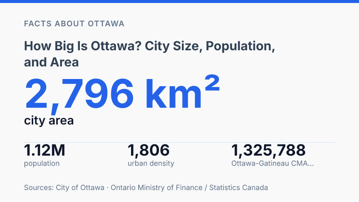
How big is Ottawa is partly a boundary question: the City of Ottawa covers 2,796 km² and maintains 6,043 km of roads, a municipal footprint the city says is larger than Calgary, Edmonton, Toronto, Vancouver and Montréal combined. That scale sits beside a 2025 municipal population estimate of 1,116,170 residents, which makes Ottawa look both major and unusually spread out. The reason is not just suburban growth.
Since the 2001 amalgamation that merged the Region of Ottawa-Carleton with 11 municipalities, Ottawa’s legal city limits have included dense urban districts, postwar suburbs, villages, farms, and large rural areas. This article explains the main population and area figures, clarifies which boundaries are being measured, and shows why Ottawa can feel larger on the ground than its population rank alone suggests.
Ottawa by the numbers: area, population, and density
Ottawa’s municipal footprint is so large that the City of Ottawa says it exceeds Calgary, Edmonton, Toronto, Vancouver, and Montréal combined. The city reports a land area of about 2,796 km² in its 2024 Annual Report, which places Ottawa in a different geographic category from most large Canadian municipalities. That size does not mean the whole city is continuously urban; it means the legal municipality contains dense districts, suburban communities, villages, farmland, and open space within one local government area.
The official population baseline comes from Statistics Canada, whose 2021 Census Profile counted 1,017,449 people in the City of Ottawa. The same census measured Ottawa’s land area at 2,788.20 square kilometres and calculated a population density of 364.9 people per square kilometre. Read on its own, that density can make Ottawa look relatively spread out compared with more compact cities, but it is an average across a very large land base rather than a description of every neighbourhood.
More recent municipal estimates show the city continuing to grow beyond the last census count. The City of Ottawa’s current population and household estimates put the year-end 2025 population at 1,116,170 residents in 484,030 households across 24 wards. That figure is not a census count, but it is useful for understanding the present scale of the municipality between national census releases.
Density is the clearest way to reconcile Ottawa’s large area with its concentrated urban districts. City rural-planning figures estimate that rural Ottawa accounted for 197,093 residents in 2025, or 17.0% of the city’s population, across about 2,360 square kilometres, or 81.5% of its land area.
By contrast, the urban and suburban parts held about 965,000 residents in roughly 534 square kilometres, producing a density of about 1,806 people per square kilometre. That urban-suburban density is more than 21 times the rural density, showing why a city can be geographically huge while still containing areas that feel unmistakably metropolitan.
What counts as Ottawa’s boundaries?
Since January 1, 2001, Ottawa’s city limits have enclosed downtown neighbourhoods, postwar suburbs, rural villages, farms, and forests under one municipal government. The current City of Ottawa was created through amalgamation, when the Region of Ottawa-Carleton and 11 municipalities were merged, according to the City of Ottawa’s Ottawa Transition Board Final Report page. That decision is the main reason the legal municipality is much broader than the continuous built-up area most people picture when they think of Ottawa.
The municipal boundary includes places that function very differently from one another. Dense central neighbourhoods such as Centretown and the Glebe sit inside the same city government as suburban communities such as Kanata, Barrhaven, and Orléans, as well as rural wards including West Carleton-March, Osgoode, and Rideau-Jock. These are not separate towns for municipal purposes, even when they retain distinct local identities or village-style settlement patterns.
A second boundary question involves the difference between the city and the metropolitan region. Statistics Canada’s Ottawa-Gatineau census metropolitan area is not the same thing as the municipality; it is a regional statistical unit that crosses the Ontario-Quebec border and includes communities tied to the urban core by commuting and economic links. Provincial population reporting illustrates the distinction: the Ontario Ministry of Finance, using Statistics Canada data, reported the Ontario portion of the Ottawa-Gatineau CMA at 1,325,788 people as of July 1, 2025, which is not a count of the City of Ottawa alone.
There is also a planning boundary inside the municipality. Ottawa’s urban boundary marks the serviced area where urban development may occur, according to the City’s urban and village boundary expansion material, but it is not the city limit.
As a result, claims about Ottawa’s size can refer to at least three different geographies: the legal municipality, the built-up urban area, or the wider metropolitan region. Those definitions can produce very different answers, so the measurement being used matters as much as the number itself.
How Ottawa compares with other Canadian cities
Toronto had almost three times Ottawa’s municipal population in the census while occupying less than a quarter of Ottawa’s municipal land area. According to Statistics Canada’s 2021 Census profiles, Toronto counted 2,794,356 residents on 631.10 km², while Montréal counted 1,762,949 residents on 364.74 km². Those figures show why population size and land area tell different stories: Toronto and Montréal are much more concentrated municipalities, while Ottawa’s municipal form spreads a smaller population across a much wider territory.
Calgary is the more useful western comparison because it also has a relatively expansive municipal boundary by Canadian big-city standards. Statistics Canada reported Calgary at 1,306,784 residents and 820.62 km² in 2021, giving it a larger population than Ottawa but a much smaller land base. The comparison helps explain Ottawa’s unusual size profile: it is one of Canada’s largest city municipalities by area, but it does not sit in the same population tier as Toronto or Montréal and trails Calgary on the census count used here.
Area rankings need context because Canada includes very large municipalities whose boundaries cover resource areas, forests, or dispersed settlements rather than a single continuous urban centre. Within the group of major Canadian cities, however, Ottawa stands out near the top by municipal area. That ranking does not mean it is Canada’s biggest urban settlement; it means the legal municipality contains a broader mix of urban, suburban, and non-urban land than most large-city counterparts.
Across the Ottawa River, Gatineau shows why the capital is often understood regionally as well as municipally. Statistics Canada’s 2021 Census counted Gatineau at 291,041 residents on 342.95 km², making it much smaller than Ottawa as a municipality but still large enough to shape the daily geography of the National Capital Region. Commuting, federal employment, cultural institutions, and cross-river transport mean the two cities operate as connected parts of one capital area, even though their municipal populations and land areas are counted separately.
Why Ottawa feels larger than its population suggests
A trip within Ottawa can feel regional rather than municipal because the same city boundary contains compact apartment districts, postwar suburbs, farms, villages, and protected open space. That distance is visible in infrastructure: Ottawa maintains 6,043 km of roads across its municipal footprint, according to the City of Ottawa, 2024 Annual Report. Road length is a practical measure of scale because it affects snow clearing, maintenance scheduling, emergency response coverage, and the cost of connecting far-apart communities.
This geography also changes how travel time is experienced. A long east-west or north-south trip across the municipality can involve highways, arterial roads, suburban centres, rural concessions, and village streets within one local government area. In a more compact city, crossing the municipality often means moving through a continuous urban grid over a shorter distance; in Ottawa, the same kind of cross-boundary journey can feel closer to intercity travel, even though it remains inside one municipal jurisdiction.
The Greenbelt is a major reason Ottawa does not develop as one uninterrupted urban mass. Its protected lands, together with other conservation and rural areas, create separation between the inner urban area and many outer communities. This pattern helps preserve open space and agricultural or natural land uses, but it also means growth often occurs in separated nodes rather than as a simple outward expansion from the centre.
The consequence is a city whose planning challenges are larger than population alone suggests. Ottawa has room for lower-density neighbourhoods, employment areas, and future expansion, but municipal services must operate across a wide and unevenly settled area. Transit planning, road maintenance, recreation facilities, utilities, and emergency services all have to account for both dense districts and sparsely settled zones, which makes the city feel physically larger than its population ranking might imply.
Why the boundary changes the answer
A single size figure can mislead when it is detached from the boundary behind it. A comparison of transit service, housing supply, taxes, or road maintenance changes depending on whether the unit is the 2,796 km² municipality, the urban serviced area, or the wider Ottawa-Gatineau region. The 2001 amalgamation made those layers part of one city government, but it did not make them function the same way.
Future growth debates will likely turn on that distinction: expanding the urban boundary, protecting rural land, and serving suburbs are different questions inside the same legal map. Any reliable comparison starts by naming the boundary first, then attaching the population figure to it.
Frequently Asked Questions
Q: What is the population of Ottawa right now?
A: Ottawa is Canada’s capital and one of the country’s largest cities by population. According to the 2021 Census, the city had 1,017,449 residents, which helps explain its status as a major urban centre in Ontario.
Q: How large is Ottawa in square kilometres?
A: Ottawa covers a very large land area compared with many Canadian cities. Its municipal area is about 2,790 km², reflecting the city’s mix of urban neighbourhoods, suburbs, rural land, and natural spaces.
Q: Is Ottawa bigger than Toronto in area or population?
A: Toronto is larger than Ottawa in population, while Ottawa is much larger in municipal land area. That difference shows how city size can mean different things depending on whether the measure is people or geography.
Q: Why does Ottawa seem so spread out?
A: Ottawa’s boundaries include extensive suburban and rural districts, not just the downtown core. That structure lowers density across the city and creates longer travel distances between some neighbourhoods and services.
Q: How does Ottawa compare with other Canadian capital cities?
A: Ottawa is much larger than most provincial and territorial capitals, both in population and land area. Its size reflects its role as the national capital, a federal employment centre, and a metropolitan area with a broad suburban footprint.